Montafoner Steinschafweg

Moderate
Alpenmosaik - Tal
Rundtour
Themenweg · Hiking · Alpine mosaic – valley · Alpine mosaic · Round trip
03:30 h duration
9,7 km Länge
1201 m Höchster Punkt
816 m Tiefster Punkt
492 hm Aufstieg
492 hm Abstieg
Kondition
Schwierigkeit
Erlebnis
Landschaft

Tourbeschreibung

The path provides information about the history and characteristics of this breed of sheep, which is native here and was endangered. The route leads from the town center of St. Gallenkirch down to the Ill River, downstream between forest and pastures to the district of Galgenul. At the bridge over the Suggadinbach, the path goes uphill along the stream towards Gargellen. Via Rüti, it continues along the Montafoner Steinschaf pastures further upstream, until the path on the other side of the valley leads back to St. Gallenkirch via Außergampaping and Neuberg.

Description

The Montafoner Steinschaf is an endangered sheep breed that was found only sporadically in the remotest Montafon. It was displaced by larger and more fattenable breeds. From 1989 on, typical animals were purchased and a breeding register was established to avoid inbreeding. Since then, the breed has been bred throughout Vorarlberg.

Approach

Drive on the A14 to the Bludenz/Montafon exit and continue on the Montafonerstraße L188 to St Gallenkirch. There, turn right into Gargellnerstraße and follow it (L192) to Gargellen until you reach the Reutehorn inn.

Public transport

Just leave your car parked

The local buses operate throughout Montafon. The main lines run every half hour from Schruns station.

Bus stop at the start/finish of the route: St. Gallenkirch center / line 650 and line 670

Timetable: www.vmobil.at

Arrival by train to Montafon

From Bludenz station, the Montafonerbahn runs hourly (partly every half hour). There are also direct connections from Lindau (D) and from Bregenz.

Timetable: www.oebb.at

Parking

For this hike, it is recommended to take the public bus from the Valisera Bahn valley station. Parking is available at the Valisera Bahn valley station.

Directions

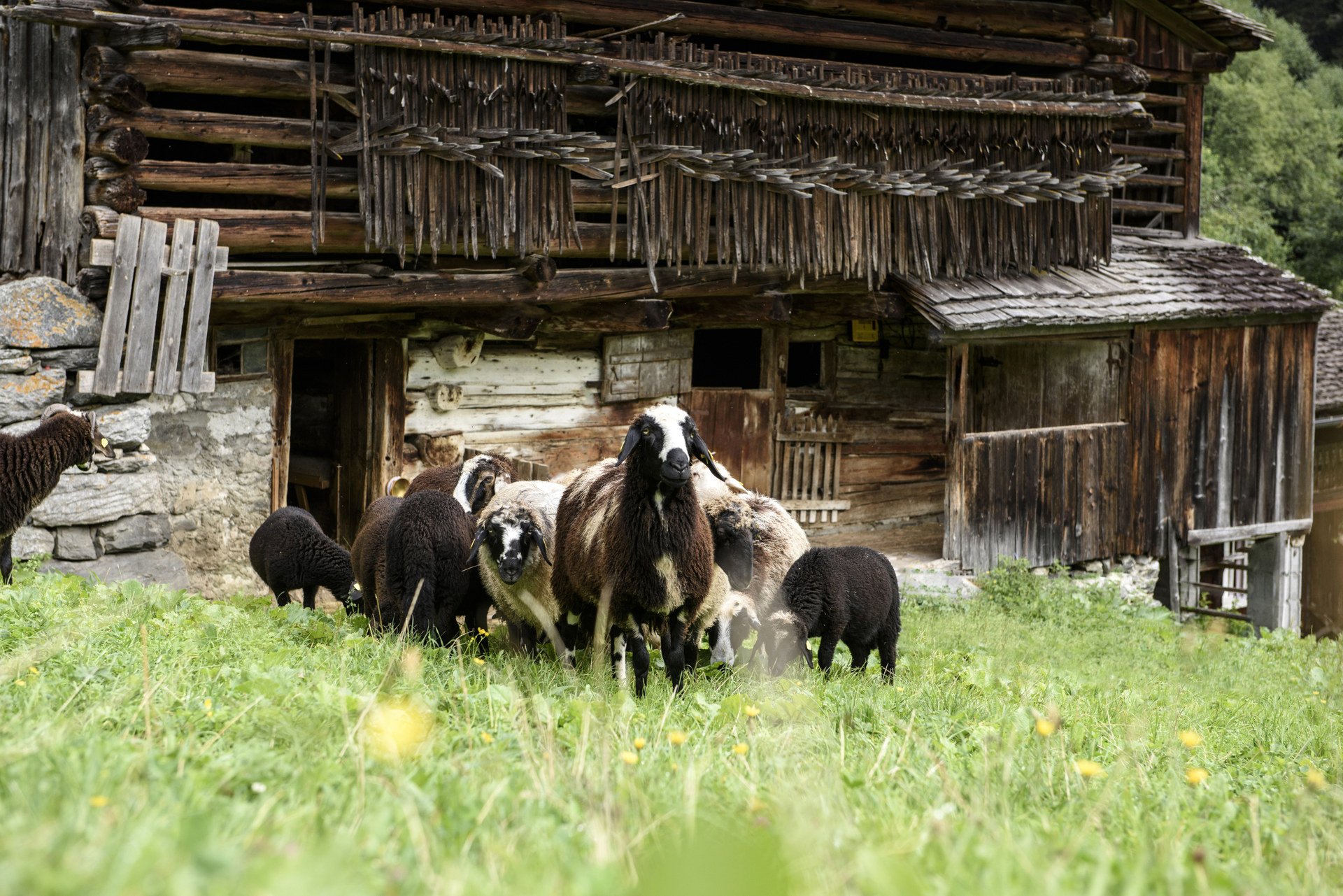
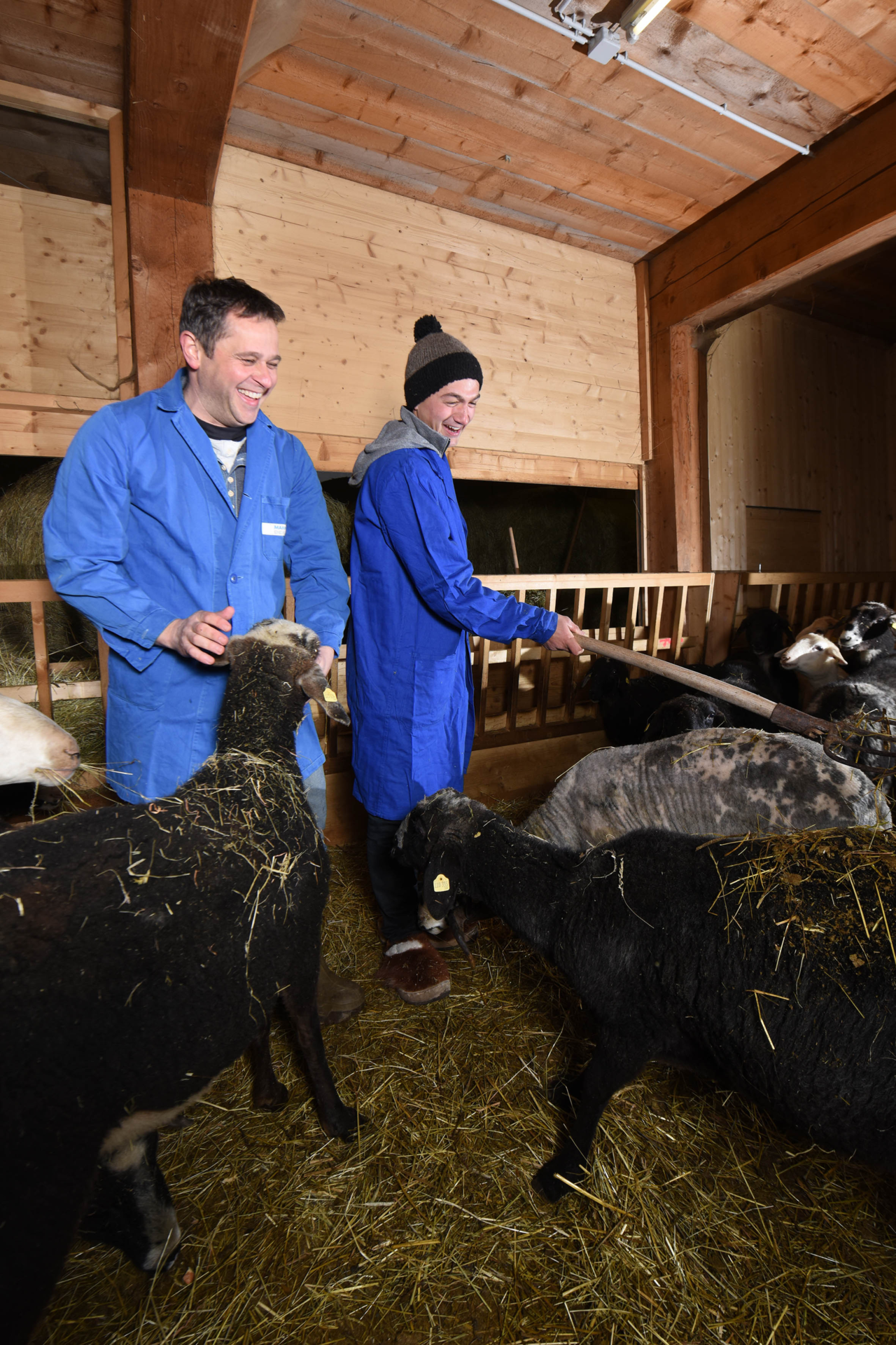
You start in St. Gallenkirch at the tourist information and walk about 50 meters along the main street towards Schruns. On the left side of the street, you will find the hiking trail signpost. From there, the path goes downhill to the Ill River. You always follow the signpost to Gargellen. At the river, cross the bridge and then turn right. Arriving in the Galgenul district, you pass the Valisera Bahn along the main road and find another signpost. From there, continue along the main road for a stretch. After the bridge over the Suggadinbach, your path goes uphill towards Gargellen, always following the signpost towards Rüti. Once you arrive at Rüti, your next stage goal is Außergampaping. From Außergampaping, continue over Neuberg to Galgenul. Now you are back at the signpost near the Valisera Bahn. Now continue for about 200 meters over a bridge along the main road. Here, you can take a short detour to the Biohof Mathis to see if the Steinschaf sheep are currently in their stable. Then follow the bike and footpath until you can turn left at the first junction back towards the town center.

Safety instructions

EMERGENCY: 144
European emergency number 112 (works with any mobile/ network)
www.vorarlberg.travel/sicherheitstipps

Equipment

good, ankle-high hiking shoes with a good grip

Destination

St. Gallenkirch, center

Starting Point

St. Gallenkirch, center

Eigenschaften
Routentyp Themenweg, Hiking, Alpine mosaic – valley, Alpine mosaic, Round trip
Schwierigkeit Moderate
Höhenprofil
Beste Jahreszeit
Jan
Feb
Mär
Apr
Mai
Jun
Jul
Aug
Sep
Okt
Nov
Dez